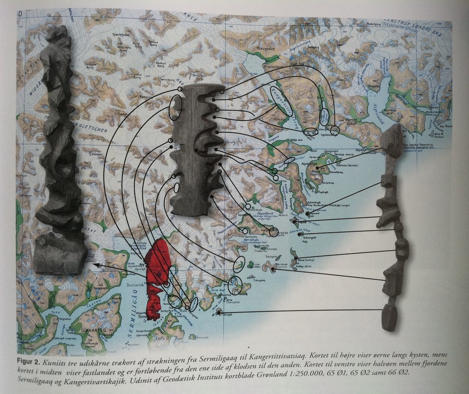
In English, the caption reads: "Kuniit's three wooden (tree) maps show the journey from Sermiligaaq to Kangertittivatsiaq. Map to the right shows the islands along the coast, while the map in the middle shows the mainland and is read from one side of the block around to the other. Map to the left shows the peninsula between the fjords Sermiligaaq and Kangertivartikajik." From "Topografisk Atlas Grønland", published by Det Kongeglige Danske Geografiske Selskab, 2000 (pg 171).
These traditional maps, carved from driftwood, have the advantage of buoyancy (so that they would float if accidentally dropped in the water) and being both visual and tactile (so that they can be read even in the dark).
No comments:
Post a Comment